Baisakhi Fm
Type Locality and Naming
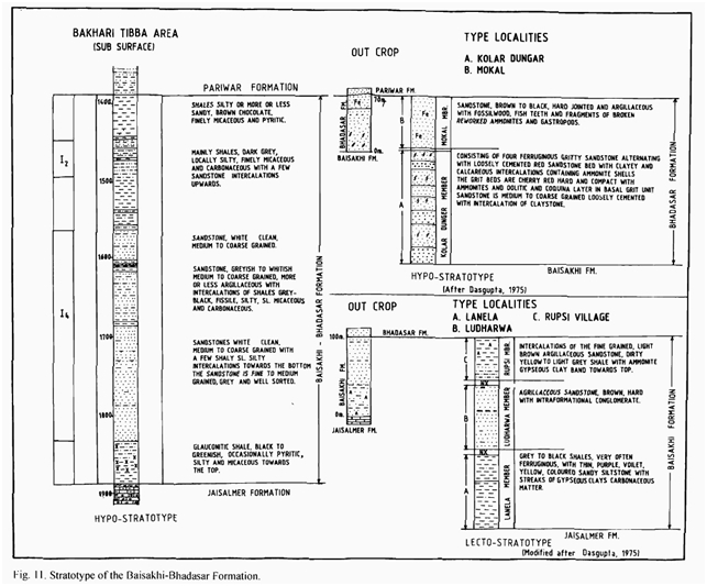
OUTCROP. Exposure at Odania and northwest of Thaiat village on Jaisalmer-Pokaran road. The complete section of Baisakhi Formation is not exposed at one locality. Therefore, Baisakhi Formation could be described from different type localities. The type localities are: west of Baisakhi village, scarp section around Ludharwa and scarp section west of Rupsi. Baisakhi Formation was mapped earlier as a part of “Jaisalmer Group”. Swaminath et al. (1959) were first to separate it from “Jaisalmer Group” as a distinct lithounit and designated as “Baisakhi Formation”. They placed its top below the basal grit of Bhadasar Formation. Subsequently, Narayanan et al. (1961) and Dasgupta (1975) gave the lithological account. [Original Publication: Swaminath, J., Krishnamurthy, J.G., Verma, K.K., and Chandak, G.J., 1959, General geology of Jaisalmer area, Rajasthan, ECAFE Symposium, Mineral Research and Development Series 10: 154-155]
Lithology and Thickness
Clayey sandstone. This formation comprises mainly an arenaceous sequence of medium to coarse-grained sandstone with interbeds of shale, claystone and occasional lignite. In the subsurface of Jaisalmer Basin it is about 600 m thick and its thick increases towards northwest. Dasgupta (1975) subdivided the formation into three members: Baisakhi Member, Ludharwa Member and Rupsi Member.
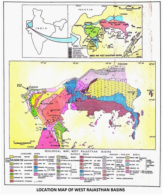
[Figure 1: Location map of West Rajasthan Basins (after Pandey and Dave, 1998)]
[Figure 2: Stratotype of Baisakhi Fm, Mesozoic Lithostratigraphy of the Jaisalmer Basin, Rajasthan, Journal of the Paleontological Society of India, Vol. 51(2) (after Singh N.P, 2006)]
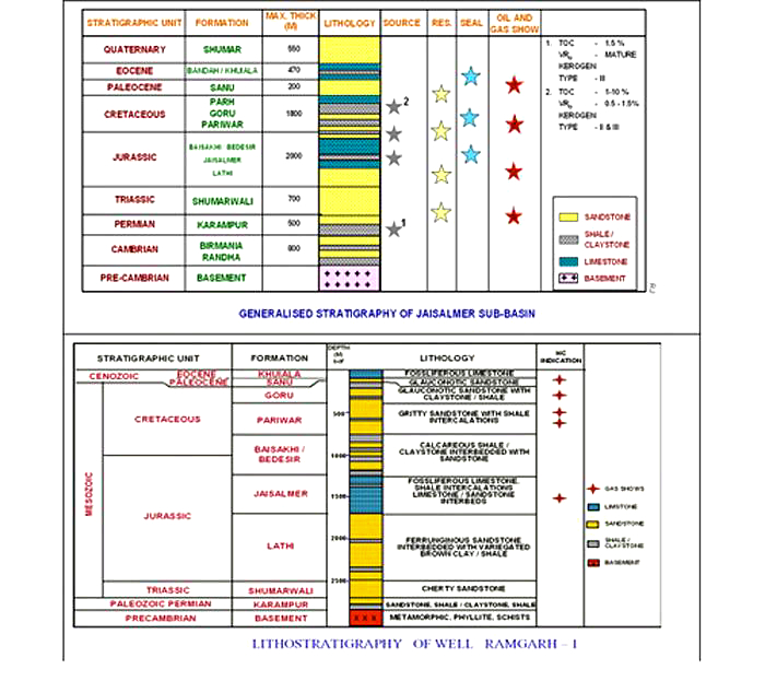
[Figure 3: Generalized and Subsurface Stratigraphy of Jaisalmer Basin (from dghindia.gov.in)]
Relationships and Distribution
Lower contact
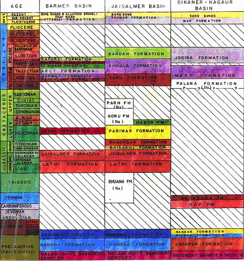
The lower boundary with underlying Bhuana Fm (Triassic) is unconformable; but is conformable to the Jaisalmer Fm (Oxfordian) where present.
Upper contact
The upper boundary to Bhadasar Fm is conformable, but difficult to distinguish (see that formation)
GeoJSON
Fossils
In outcrops fossilized tree trunks were reported by Ritcher et al (1957). Later on Verma (1960) reported leaf impressions of Ptillophyllum.
Age
Depositional setting
Fluvial-deltaic
Additional Information


